


Learn The Ropes app for iPhone and iPad
Developer: Stephen Ford
First release : 05 Oct 2017
App size: 81.54 Mb
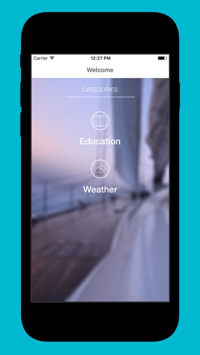
Learn the Ropes is an educational boating app for all mariners providing safety and navigational tools to learn and continue to revise the rules of the waterways.
Learn the Ropes is suitable for all ages and groups who are planning to or partake in recreational or commercial activities on the water.
We want to make safety information readily available to all sea going mariners to support safety and happy boating experiences.
Whether you are applying for a boat licence, planning to sail the world or studying to work in the maritime industry, this is the perfect learning platform to develop your knowledge and / or maintain your knowledge of the fundamental and essential safe boating practices.
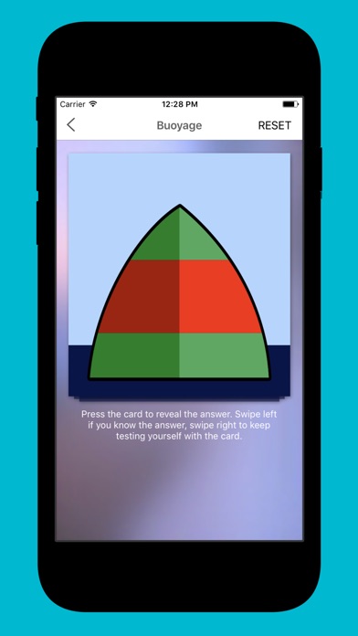
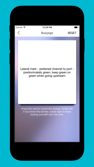
This apps core feature is the use of flip card style learning by which an image or prompt is displayed and on the reverse side of the image, the answer awaits in case the user does not know the appropriate answer. It includes buoyage, lights, day shapes, phonetic alphabet and an additional weather tool so you can check the forecast from within the application.
Planned releases will see the ongoing development of this application to include additional advanced topics, expanding into the many other areas of maritime safety.
** it is important to note that this app is designed for IALA Bouyage System A.
Region A comprises nations in Europe, Australia, New Zealand, parts of Africa and most of Asia other than the Philippines, Japan and Korea.
Region B comprises nations in North America, Central America and South America, Philippines, Japan and Korea.
If you are in region B areas, the lateral buoyage markers are reversed...... ie in System A - when going upstream keep green on green. System B - when going downstream keep green on green!
This application uses data from © OpenStreetMap contributors for the weather information. Their copyright information is available from their site - http://www.openstreetmap.org/copyright